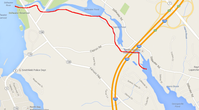
Last night, I ventured out to see if I could canoe from Georgiaville Pond, to Capron Pond, to Stillwater Pond, finally to Stillwater Reservoir.
It looks like a great idea on the map but what the map shows as thinner streams are not boat-able. In between Georgiaville and Capron is a rocky stream and a waterfall. The north end of Capron pond is composed of 6″ water depth, 3′ mud and 4′ of weeds.
In short, it cannot be passed with a reasonable level of effort.
Leave a Reply